Welcome!

Welcome to the Gulf of Maine Coastal Ecosystem Survey (GOMCES) blog! Here we will keep you updated on the progress of our project, and in particular, any of the exciting and interesting findings and observations from our at-sea surveys. Set to begin this Monday, we will be traveling throughout the coastal Gulf of Maine region on an integrated, ecosystem cruise to collect data on everything from plankton to whales.

GOMCES transects

The GOMCES survey transects and corresponding dates.

Although the Gulf of Maine coastal waters are incredibly ecologically and economically important, there are still many questions that remain unanswered. We hope you continue to follow our adventures to help answer these questions and increase our understanding of marine ecosystem dynamics in the coastal waters of the Gulf of Maine.

Where’d everybody go?

The GOMCES crew has been back on terra firma for about two weeks now, giving everyone some time to reflect on this summer’s survey. Although we have yet to delve into the data analysis, when asked how the survey went, our first response is usually something along the lines of “It seemed like a ‘slow’ year.”

So, what does a “slow” year look like? That is a great question. While we don’t have a concrete answer yet, here are some observations that coincided with what seemed like a “slow” year.

First, let’s start with the physical setting. Many of these physical setting characteristics did not change among the survey years. For example, we surveyed many of the same transects this year as we have in past years, covering a similar range in depths/distances from shore and seafloor habitats. However, the physical properties of the water column are variable. These properties are also key components of the ecosystem, setting the stage for patterns of growth, survival, transport, and/or reproduction for many organisms.

As you may recall, we use a conductivity-temperature-depth (CTD) meter to measure several key physical properties. Comparable data are also available from monitoring buoys anchored at several locations within the Gulf of Maine. As it will be some time before we process our CTD data, we pulled water temperature data for three different buoys from the NERACOOS website to give us a general picture of what was going on with the physical oceanography this summer. The buoy data are displayed below, along with a map of the buoy locations for orientation. The blue line depicts the average temperature from 2001-2015, the yellow window shows the range in observed temperature values from 2001-2015, and the brown lines and points are the observed temperatures for the particular year of interest.

Slide1

A sample of 2015 and 2016 water temperatures recorded at three monitoring buoys within the Gulf of Maine. 

The buoys tell us that in general 2016 has been a fairly warm year so far in the Gulf of Maine, with warmer water temperatures at depth (and at the surface) than the 2001-2015 mean water temperatures. That being said, there is some considerable variability around the mean – especially towards the southwest Gulf of Maine and Massachusetts Bay area. Although a plot of water temperature at one depth and a few different buoy locations doesn’t tell the full story about if the entire water column is “warmer” or “colder” than previous years, it does seem like overall conditions were warmer during this summer’s survey than years past (2015 data are shown for comparison).

Ultimately our project is focused on evaluating how such physical oceanographic changes affect the distribution and abundance of the biological organisms living in the coastal region. During this summer’s survey, there did seem to be considerable differences in the species we encountered and their abundances compared to past years. One of the most obvious differences was the number of gelatinous zooplankton we caught in the zooplankton ring nets and observed from the boat.

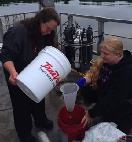
Gelatinous zooplankton are notoriously hard to sample with ring nets given their delicate bodies. So, instead of true counts, our biological oceanographer scores the sample from 0 to 10 based on how much gelatinous material is in the sample, with 0 being none and 10 being a lot. We are in the process of mapping these scores to compare with the earlier years (2015 example shown below). Already, though, the data suggest that gelatinous zooplankton abundance was down considerably compared to previous years, with most of the ring net tows scoring 0 or not much higher. In contrast, abundances of other zooplankton species, and especially the star-of-the-show Calanus finmarchicus, appeared to be on par with previous years. (You may remember from previous years’ blog posts that C. finmarchicus is a very large, fatty copepod that serves as a very important food source for many of the Gulf of Maine’s denizens, from juvenile fish to large baleen whales.)

Picture1

2015 map of relative gelatinous zooplankton abundance throughout the coastal Gulf of Maine. 

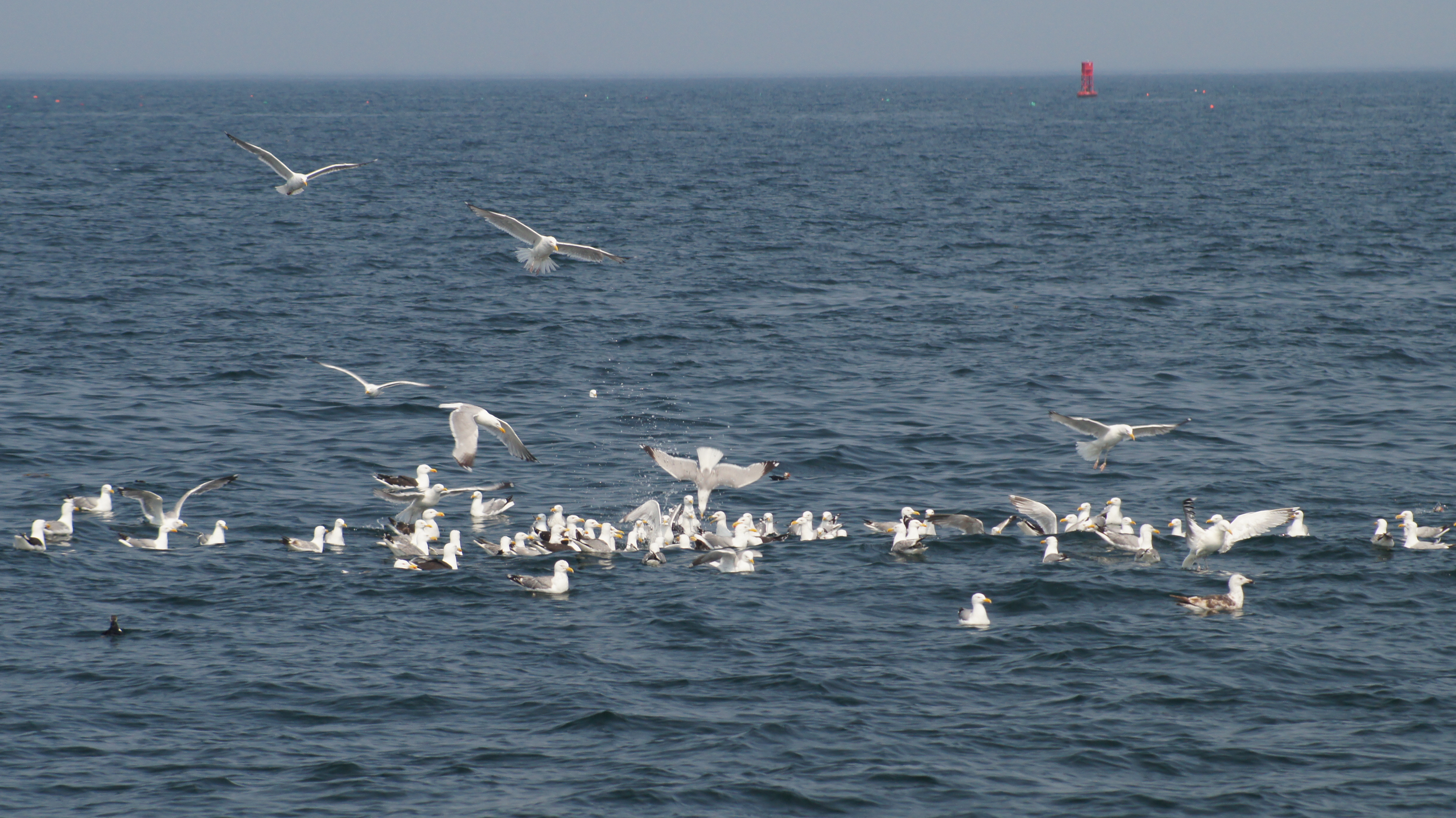
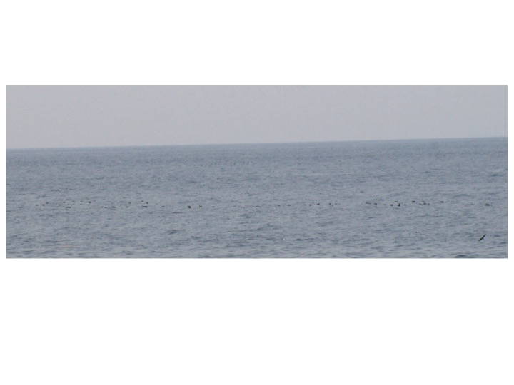
In addition to being a slow year for gelatinous zooplankton, 2016 was also slow for the marine bird and mammal team. In total, the number of individuals observed in many of our marine bird groups were lower in 2016 than in 2015 or 2014. This includes species like Wilson’s storm-petrels, Great shearwaters, Arctic and Common terns, Atlantic puffins and Razorbills. Across the board, our preliminary data processing suggests that we encountered fewer individuals of these species in 2016.

Along with lower total observation numbers, we also failed to encounter a tern or alcid foraging flock. In both 2014 and 2015, the marine bird and mammal crew observed at least a few of these foraging flocks, comprised of multiple species and at least 25 or more total individuals. With the exception of the shearwater foraging flock observed on the first day (keep in mind that these birds are currently “wintering” here and will soon return to their southern hemisphere breeding colonies to start their own breeding season), the crew did not come across any other foraging flocks in 2016. Of course, missing a foraging flock might just be a case of wrong-time/wrong-place. However, when combined with fewer total observations, it definitely contributes to the perception that 2016 was a “slow” year.

Where does that leave us? Well, a quick recap. 2016 appeared to be a “slow” year. Water temperatures seemed to be warmer than long-term averages, and especially, warmer than 2015 (which was a fairly cool year). Gelatinous zooplankton were less prevalent, while other zooplankton species, including Calanus finmarchicus, appeared to be similar in abundance to previous years. Total observation numbers of key marine bird species were lower than the past two years and we didn’t see as much foraging activity. We’ll also add that we saw fewer marine mammals and Mola molas (Ocean sunfish) in 2016 (remember that Mola molas eat primarily gelatinous zooplankton!).

There are many possible explanations for these yearly differences. Although it might just be a case of poor timing on our part, patterns may emerge during data analysis that will give us insight into the reasons behind the interannual variability. Right now, what really seems to be sticking out is the difference in the relative abundance of gelatinous zooplankton. That being said, we might be a bit biased since correlating the low gelatinous zooplankton year with lower marine bird/marine mammal observations and activity would strengthen our growing idea of the important (and underappreciated) role that gelatinous zooplankton may play in the Gulf of Maine food web. In any event, we are all excited to confront our knowledge of the Gulf of Maine coastal ecosystem with the data we have collected over the next few months.

Thanks for following along this summer! We hope to have some updates as we continue with our analysis. Additionally, although we are at the end of this project’s funding, we are hoping to secure funds for additional future surveys to keep this important effort going!


Rockweed sampling

Hello dedicated GOMCES blog readers!

We are assuming none of you have gone into severe withdrawal waiting for the next blog post while we have been on a week long hiatus. Much like the work for this summer’s survey, the blog posts have been coming in fits and starts. In past years, it was pretty easy to get into a routine: wake up, have an everything bagel, work, steam to the next port, have dinner, write blog, repeat. Getting into that same routine this year was a bit harder since it seemed like we never had two days in a row when we knew what our plan was going to be. While we were still able to get most of our survey work done, the blog posts got put on the backburner amidst the constantly changing schedule. But, rest assured, although they have been post-poned, they were not forgotten and we still have a few more interesting stories to share, including our adventure into rockweed mat sampling.

For those of you who have been reading since the beginning of the GOMCES project, you will be familiar with our newfound interest and appreciation for rockweed mats. In particular, there seems to be a strong connection between these rockweed mats and foraging marine birds. Despite our diverse science team, we didn’t anticipate sampling rockweed mats at the beginning of the project. Fortunately, we were able to make some adjustments before this year’s survey to bring Sam, our dedicated rockweed-sampler, on board for the cruise.

During the southern transects, Sam’s patience was put to the test as we did not encounter any rockweed mats along our survey transects. Luckily, things began to get more exciting as we came across our first rockweed mat on our eastern Penobscot Bay transect. As Capt. Bryan slowed down the Gulf Challenger, Sam, Julek and the rest of the GOMCES crew quickly went to work to collect the sample.

The rockweed sampling procedure is somewhat unique among our different data collection efforts, although, it does have some similarities to our biological oceanographic zooplankton sampling. While on the bow of the boat, Sam searches the area for mats. If she sees one, she then calls in the distance, angle, relative size and density of the mat to the data recorder down below. Depending on its characteristics, Sam then directs Capt Bryan to position the boat so that Julek can grab a quick sample of the rockweed using a dipnet. The sample is then put in a ziplock bag in a cooler until Sam has time to process it – usually after we had made it to our next destination port, resulting in long work days for Sam, and her helper, Aly!

After the sample is collected and we reached our next port, Sam and Aly would work to process the sample. First, Sam took the sample out of the Ziploc bag and placed it in a bucket of fresh water, gently swirling while the sample was immersed in the fresh water for at least 10 minutes. This fresh water immersion process separates the animals living on the rockweed from the rockweed itself.

After separating the sample, Sam removed the rockweed and other large pieces of plant material from the bucket, leaving behind anything that fell to the bottom of the bucket. With the rockweed removed, Aly poured the remaining bucket contents through a small, sieve net.

Sample

With the larger pieces of seaweed removed, Sam and Aly work to pour the remaining sample contents through a small mesh net. 

This filtering process further isolated the small animal organisms living amongst the rockweed so that they could be stored in a small sample vial for later identification and counting.


Finally, the removed rockweed clumps and other pieces of organic matter were photographed and identified.

Last

A collection of larger seaweed species, removed earlier in the process and placed aside for photographing and species identification.

Ultimately, Sam and her advisor at Unity, Dr. Emma Perry, hope to use these samples to characterize the invertebrate biodiversity and seaweed biodiversity among different rockweed mats. In doing so, they are hoping to investigate how these communities vary spatially, both in terms of their along-shore position (for example, Penobscot Bay vs. Jordan Basin) and their distance from shore. Are all of the communities similar, with the same organisms found in mats nearshore and offshore? Or, are there unique organisms found at different mats, either in different regions or at different distances from shore? While interesting as independent questions, the rest of us are also selfishly hoping that their findings may also shed light on why birds and other larger marine organisms seem to key in on these rockweed mats when foraging.

Casco Bay transect and unpredictable weather

Casco Bay Transect

On Wednesday, the crew departed from Portland and surveyed our Casco Bay transect before spending the night at the Bigelow Lab for the Ocean Sciences dock. The seas were calm and the sun shining, but not much was going on from a sampling or observing perspective. The major exception was the first occurrence of rockweed mats on survey transects. While on the first transect leg, we began to see small chunks of rockweed, mainly Ascophyllum nudosum and Fucus vesiclosus. As we got a bit father offshore to the northeast, the seemingly random, smaller chunks eventually turned into mats. Although easily seen from the boat, figuring out how best to record their presence and size along the transects proved a bit more challenging. Eventually, the observing team decided that we would record the presence or absence of discards every five minutes along with our buoy counts. For mats, we began recording the distance to the mat center, its size and also the density of the mat. This might not be the perfect sampling protocol and we may end up doing some refining as we continue along the coast, but for now, it will definitely help to give us a better idea of the distribution of rockweed mats and their association with foraging marine birds and mammals.

Unpredictable Weather

During the past two survey years, we have run into some weather when we got to Bigelow/Boothbay, preventing us from surveying offshore near Matinicus Rock and Seal Island — two important marine bird colonies within the Gulf of Maine. This year, though, it looked like maybe things would be different. After finishing dinner at the Bigelow Shore Facility, we discussed our plan to head offshore the next day before working our way back into Penobscot Bay and docking in Stonington for the night. Everything looked promising for a productive survey day, filled with puffins and razorbill sightings.

Unfortunately, the weather had other plans and things changed quickly overnight. When the crew got up the next morning, we were greeted by a wall of fog and some unpleasant seas.

IMG_0503

The foggy view heading as the crew departed Bigelow and headed towards Penobscot Bay and Stonington. While calm in the Damariscotta River, we were quickly met with rough seas as we came out of the river and made the turn northeast.

Capt. Bryan and first mate Jim navigated us safely through the maze of buoys and between the different islands through some rough seas, while the rest of us lazily slept below. As we came into Penobscot Bay, the decision was made that we would head directly to Stonington as conditions were too poor to complete any sampling. We arrived in Stonington in the early afternoon and while Bryan and Jim got some much deserved downtime, the rest of us ventured into town for the afternoon, hoping for the weather to improve.

IMG_0509

A gray day in Stonington.

Despite our wishes, the weather won again. Given poor weather forecasted for Friday-Sunday, the crew decided that our best bet would be to leave the boat in Stonington for the weekend and come back on Sunday night to try to complete the downeast work during the beginning of next week. So, with the new plan, everyone scrambled to find rides home. Thanks to some special help from the McGarrigle’s (Sam’s mom and dad), Bryan and I were able to make it to Bangor and are currently sitting in the Concord Coach bus station awaiting our ride and hoping for good weather at the start of next week to finish off the downeast section of our cruise.

Hope everyone has a good weekend and see ya Monday (hopefully)!

Offshore terns and the pteropod mother lode (not load)

Welcome back dedicated GOMCES blog reader(s)!

Before the holiday weekend, the crew finished up the southwestern region of the survey, completing the Isle of Shoals/Jeffreys Ledge transect. Overall, it was fairly quiet from the biological oceanography and fisheries acoustics side of things. However, the marine bird and mammal observing team was surprised to find a number of Common terns foraging farther offshore than we could remember observing them during the previous two years (maps coming once the internet is a bit faster!).

These observations were especially interesting given a recent email exchange we had with Linda Welch (Biologist, USFWS Maine Coastal Islands National Wildlife Refuge). In her email, Linda mentioned that tern numbers seemed to be down at many Maine coastal breeding colonies this year. Could this explain why we saw more terns than usual on the Jeffreys Ledge Transect? Perhaps! Seabirds nest on land, but they catch food at sea to feed themselves and their growing chicks. The farther the bird has to travel to feed, the longer the chicks have to wait between meals – beyond a certain distance (which varies a lot by species), the process becomes impractical. Therefore, parents are constrained to forage within some reasonable distance of the colony, even if the food is better elsewhere. In contrast, birds that fail to produce chicks are NOT restricted to foraging near the colony and presumably can follow the food wherever they happen to find it – possibly like the terns we observed foraging far offshore the other day.

Of course, this is all speculation based on a handful of observations, which is great for helping us to formulate hypotheses, but is a terrible foundation upon which to draw actual conclusions! So we will continue to observe and ponder and see what the full dataset tells us upon completion of the survey.

Wilkinson Basin and the pteropod mother lode

Yesterday morning, the crew met in Portsmouth to begin the trek up the Maine coast, starting with the Wilkinson Basin transect. There are two main reasons for sampling the Wilkinson Basin transect. First, it covers deep basin waters, which many times host great abundances of large, lipid rich zooplankton species, such as Calanus finmarchicus – a pivotal species within the Gulf of Maine food web. These basins are also a unique bathymetric feature to the Gulf of Maine and provide a good contrast to the shallow, coastal waters surveyed by many of the other transects. Second, the transect includes a biological oceanographic time series station that is sampled semi-regularly by researchers from UNH, GMRI and UMaine. So, while all of these transects are interesting for the fisheries acoustic and marine bird/mammal team, the Wilkinson Basin transect is especially relevant to the Biological Oceanography team on this project.

As Cameron poured the contents of the first zooplankton net tow through the sifting tray, the crew immediately noticed a collection of extremely small, dark colored organisms mixed in with the usual suspect, Calanus finmarchicus. We also noticed a larger, gelatinous looking species with orange coloring. Cameron took a closer look at the sample while we awaited his announcement … both new organisms were pteropods!

Pteropods

The two species of pteropods caught at the Wilkinson Basin time series station.

Pteropods are small, gelatinous mollusks (the phylum that includes snails, clams, squid, and many other easily recognizable marine creatures) and are a key prey item for many higher trophic level species. Pteropods are commonly referred to as “sea butterflies” because they have two wing-like lobes that help to propel them through the water. The smaller pteropods in our sample were members of the Limacina retroversa species in the Thecosomata order, the most common pteropod species in the Gulf of Maine. Over two years of surveys and almost a hundred zooplankton samples collected, this was the first time many of us had seen these little creatures in such quantities.

The large pteropod in our sample was Clione limacina, a member of the Gymnosomata order, also called “naked pteropods” because they lack a hard outer shell. Interestingly, these pteropods are a predator of Limacina pteropods. Given this predator-prey relationship, it makes sense to find two species from these different taxonomic orders at the same location.

During recent decades, interest in pteropods, and especially Thecosomata pteropods, has increased given the growing concerns of global climate change and its effects on marine organisms. While increasing temperatures driven by global climate change capture many headlines, ocean acidification is also a primary concern. Ocean acidification is the term used to describe the decreasing pH of the ocean (or the increasing concentration of hydrogen ions in the ocean). The process that results in ocean acidification brings back nightmares of organic chemistry, but here is my best explanation:

The atmosphere and the ocean are coupled together in many different ways. One of the consequences of this tight coupling is that as concentrations of CO2 rise in the atmosphere, the ocean absorbs some of this extra CO2. Once in the oceans, CO2 is quickly brought into chemical reactions (see here for a nice diagram), reducing the number of carbonate ions available to build shells and skeletons for organisms like Thecosomate pteropods. Even after formation, evidence suggests that increased CO2 levels can cause shell deterioration.

Within our region, there is still a lot of work left to be done to understand how the chemical makeup of the Gulf of Maine is changing and what this may mean for marine organisms. Interestingly, the work that has been done seems to suggest that the Gulf of Maine may be particularly vulnerable to ocean acidification for two reasons. First, many rivers and streams empty into the Gulf of Maine, and this freshwater runoff can drive pH down, especially in localized regions around river and stream mouths. Second, the cold Labrador Current brings a constant influx of cold water into the Gulf of Maine, and = colder waters are able to dissolve more CO2. Many researchers are currently investigating the unanswered questions concerning the potential effects of ocean acidification on shellfish and other populations in the Gulf of Maine. You can read more here.

Tomorrow we head to our western Penobscot Bay transect and plan to survey near some of the larger tern, puffin and razorbill colonies within the state, so be sure to check back for another update!

– Andrew, Aly and Sam


The Rockweed Mat Initiative and Our Newest Crewmember

As mentioned in the previous post, we’ve been joined this year by Samantha McGarrigle, a senior at Unity College in Unity, ME. Samantha is a native of Hampden, ME. She is currently pursuing a Bachelor of Science in Marine Biology and plans to continue on to study marine community ecology in graduate school after graduating from Unity next spring.

P1160718

Samantha McGarrigle, intern extraordinaire

Sam’s main role with us this summer is to help document and investigate offshore floating macroalgal mat communities. In previous surveys, we noted that some birds seemed to be associated with such “seaweed” mats floating far offshore, and that the mats seemed to harbor little micro-communities of nearshore fish and invertebrates. Steve Kress and Paula Shannon of the National Audubon Society’s Project Puffin contacted us about seeing puffins return to colonies with rockweed, so we all wondered if these mats might provide easily detectable foraging opportunities for birds looking for small fish. This summer we hope to get a better sense of the distribution and abundance of these mats, in addition to sampling their associated communities that we have only glimpsed in previous work.

SONY DSC

One of many floating macroalgal mats that we observed on downeast transects last summer.

Sam will be surveying for algal mats from the bow, alongside the bird observer (Aly or Andrew), so that we can document the location and approximate size of each mat we encounter on transect. She will be collecting meiofaunal (tiny animals) samples from up to 20 mats that she will be analyzing in conjunction with Dr. Emma Perry of Unity College. Dr. Robin Seeley (Cornell, Shoals Marine Laboratory) may be joining us for a day during the later part of the survey to help further the investigation.

To date, however, we have yet to observe a single algal mat on transect in 2016! If memory serves, though, we observed them mostly (if not entirely) in the downeast transects in previous surveys. As we are fond of saying, though, “zeroes are data, too!” – knowing where the mats are NOT may be just as important as knowing where they ARE. After all, there are no puffins in this part of the Gulf of Maine either – coincidence? (Probably.)

Until next time!

Here we go again!

And so begins the Summer 2016 Gulf of Maine Coastal Ecosystem Survey!

After an uneventful calibration day on Tuesday, we hit the seas yesterday morning to begin our third summer survey of the Gulf of Maine. The core research crew from last year returned (with Cameron on plankton, Julek on fish, and Andrew and Aly on birds) and were joined by Unity student Samantha McGarrigle who will be collecting data on floating rockweed mats. As always, Captain Bryan Soares is piloting the Gulf Challenger, and Deb is serving as deckhand-in-chief for the southern leg, flawlessly operating the winch and generally keeping us all safe and comfortable.

To review our purpose and methods for the uninitiated, our integrated ecosystem survey is an attempt to observe, sample and measure many different ecosystem components at the same time from the same survey platform. We travel set routes called “transects” dispersed over the Gulf of Maine coastal shelf, all the way from Cape Cod Bay up to far downeast Maine. As we survey each transect, we collect data on zooplankton, fish, and the physical characteristics of the water column. In addition to these data, we also record the distribution and abundance of all marine birds and mammals we observe as we travel along each transect. This multipronged approach allows us to paint a fuller picture of the ecosystem conditions during the time frame of each survey.

P1160656

Aly and Andrew prepare to wrassle the CTD over the gate while Julek gives helpful last-minute scientific insights.

Yesterday, we surveyed two transects on Stellwagen Bank. While we didn’t get treated to the same humpback whale feeding frenzy we got to experience there last summer, we did get to document many shearwaters (a fairly even mix of Sooty, Greater, and Cory’s) and storm-petrels. We didn’t miss out on whales altogether, though; at the end of the first transect, we spotted a breaching humpback whale several kilometers distant.

The highlight of yesterday’s work came at the end of the final transect, when we came upon a developing forage flock of shearwaters, gulls, and storm-petrels. Aly was the observer on deck while Andrew tried to keep up with the instantaneous data entry down below. When first spotted, the forage flock numbered about 10 shearwaters, but as we drew closer, the flock quickly burgeoned to more than 75 birds as shearwaters and gulls approached from all directions, presumably drawn by the foraging activity of their compatriots. We performed our final depth profile and plankton sampling casts of the day as the feeding frenzy continued around the boat. Any chance to sample where birds are actively foraging is extremely valuable.

P1160683

The early stages of the forage flock formation we documented on Stellwagen Bank.

While we sampled the water, Julek dropped a fishing line to the bottom in an attempt to catch fish that were showing up on his acoustics screen – the acoustic sampling is great for identifying size classes of fish, but not necessarily species, so it’s good to groundtruth when we can so that we can actually match fish species to signal characteristics. Almost immediately, he began reeling in a legal-sized haddock, followed by a couple more bites and two more haddock landings – clearly there were groundfish down below the forage flock.

JulekFish

Julek shows off the catch of the day — haddock from deep beneath our forage flock.

We bird researchers found this development particularly interesting, as we’ve recently had many discussions about “seabird forage facilitators.” Many seabirds in the Gulf of Maine are surface feeders, presumably spotting prey from the air and snatching it from the upper meter of the water column. However, fish can easily evade such aerial predators by staying below the well-lit upper meter of the water column. Of the forage flocks we’ve observed over the course of this project, all have been associated with what we’ve termed “facilitators” – bird (e.g., puffins), fish, or mammal species that can hunt at depths and may incidentally drive prey to the surface waters where they are vulnerable to surface-feeding seabirds. So was it a coincidence that haddock were active underneath yesterday’s forage flock? It’s an intriguing question that we’ll undoubtedly continue to explore as the survey progresses.

Unfortunately, today’s survey of Cape Cod Bay was not nearly so exciting. While there were a fair number of gull and shearwater spottings on the first transect, the second and final transect of the day included several miles with not a bird in sight. Tomorrow promises to be more exciting, however, as we’ll be heading out to Jeffrey’s Ledge. Stay tuned!

Making efficient use of an open workday: Blue Hill Bay and Isle au Haut Puffin hotspot

With the great weather this year allowing us to complete all of our transects as scheduled, we had an open workday to fill. During our steam into southwest harbor, we sat down to discuss how to best use the day. There seemed to be three options:

  • Survey near Metinic Island and Matinicus Rock, a section of Penobscot Bay that could be sampled more exhaustively;
  • Head back out to Jordan Basin near the storm-petrel hotspot and complete a few stations/transects to collect information that might help us better understand the reasons for the high bird activity in the area;
  • Head to Blue Hill Bay, where there is a tern colony and where the group found a high number of foraging terns the year before, and then head to the Isle au Haut puffin foraging spot. Similar to option #2, the objective of option #3 would be to add physical and biological information to figure out why birds are foraging in certain locations and not in others.

Of course, there is not a single right answer. Ultimately, after discussing all the trade-offs, we decided to go with option #3.

The next morning, we had a fairly relaxed stat with a short transit time between Southwest Harbor and Blue Hill Bay. Entering the Bay, Bryan maneuvered the Gulf Challenger to just south of the Ship Island tern colony. Ship Island is one of seven managed marine bird breeding colonies in the Gulf of Maine; four are managed by the US Fish and Wildlife Service (USFWS) and three by the National Audubon Society, through a partnership with USFWS. At these islands, summer intern researchers collect a plethora of information on marine bird breeding biology. For more information and to follow along, check out their blog!

With the boat just south of the colony, Aly and Julek were on the bow trying to figure out dominant flight paths of birds either leaving the colony or returning with fish. It didn’t take long before they noticed a mess of birds flying southeast from the colony and northwest back to the colony. We had Bryan travel in this direction and within a few minutes we had located a large (~20-30) group of foraging terns.

As we approached the foraging group, we paused to deploy the acoustics pole. We then continued to drive until we got to their general area and collected physical oceanographic measurements with the CTD and lower trophic level biological data with the zooplankton ring net and neuston net.

Now that we had our used foraging location, we wanted to sample a few other locations were there was less foraging activity for contrast. While on the first station, we noticed a visible seam on the water’s surface, which became more interesting as we drove across the seam and observed a dramatic change in depth. So, we took more samples in this nearby, but much deeper, location. Although only a kilometer or less away from the foraging spot, there was no tern foraging activity at the second location. Finally, for our last location, we headed out the bay in the same southeast direction for 45 minutes. We reached a spot that had a fair amount of rockweed (something that terns seem to key in on) and did a station there.

The idea with sampling three stations was to try to collect data where there were foraging birds and where there were not foraging birds. Additionally, by spacing out the stations, we are hoping to get better information on the spatial variability in the physical oceanographic characteristics as well as the distribution/abundance of lower trophic level zooplankton. In combination, we hope this will help us learn more about the mechanisms behind bird foraging hotspots.

After finishing the Blue Hill Bay work, we still had some time before we needed to be at Isle au Haut. So, we headed to the spot where we saw all the foraging Atlantic puffins a few days before, just south of the island. As we got closer, the crew immediately took notice of ~50 gulls and ~20 terns foraging at a distinct location. All of these animals were foraging at an area that couldn’t have been any bigger in diameter than your standard one car garage. With the acoustics pole in the water, we drove closer to them and noticed that mixed with the gulls and terns were around 40 Atlantic puffins and 20 Razorbills!

The forage flock south of Isle au Haut from a distance.

The forage flock south of Isle au Haut from a distance.

Approaching the foraging flock, look closely for the Puffins.

Approaching the foraging flock, look closely for the Puffins.

The same flock up close. Notice the puffin in the foreground -- most of them were down under the water, helping keep the bait ball in tact.

The same flock up close. Notice the puffin in the foreground — most of them were down under the water, helping keep the bait ball intact.

When we approached, the birds dispersed and the bow crew noticed something strange in the water where they had been foraging. At first it almost looked like a Mola mola. But, looking more closely, the crew realized that it was in fact a bait ball. This was a first for many of us, to see such an incredible number of fish packed so tightly together. The ball was about the same size or just bigger than a lobster bait barrel. No wonder why the birds were so close together.

The crew completed a station at the puffin foraging location and got to thinking about how to study the processes creating these very fine scale foraging patches. There are definitely some interesting questions that might fuel GOMCES 2.0, which would take on more of a fine-scale patch dynamics approach than the current GOMCES work that is using a broader and coarser scale study design to get a better understanding of regional species distribution and abundance patterns.

Jordan Basin and Machias Seal Island: Storm-petrels and more interesting neuston samples

Southwest Harbor

Southwest Harbor

Yesterday morning the crew woke up to another great weather day and headed out of Southwest harbor to survey our Jordan Basin transect.

The Jordan Basin transect starts in Frenchman’s Bay, which is just northeast of Mt. Desert Rock. It then heads southeast, cutting across an area known as the Schoodic Ridges before ending in Jordan Basin. The full length of the transect likely spans across the width of the Gulf of Maine coastal current. Like our Wilkinson Basin transect, the Jordan Basin transect was mostly designed to capture dominant nearshore to offshore physical and biological oceanographic gradients. It was also designed to sample deep, basin waters that could be important for the energy-rich zooplankton, Calanus finmarchicus.

Things started off quiet enough on the survey, but after our second station, everything picked up. From the bow, Aly started calling out foraging Wilson’s storm-petrels. First a group of two, then 5, 10, then 20 and then 60! Although we had seen a number of Wilson’s during last year’s survey, we didn’t come across anything close to these numbers and dense aggregations of foraging storm-petrels. These little guys are hard to take pictures of, but here are a few.

The group of storm-petrels

The group of storm-petrels

Foraging storm-petrel hotspot, near Jordan Basin.

Foraging storm-petrel hotspot, near Jordan Basin.

Listening to the radio from the wheelhouse, Julek quickly chimed in that the echogram was showing some incredibly interesting things, with a strong bottom layer and then a strong surface layer.

Screen shot from the hydroacoustics echogram at the storm-petrel foraging hotspot.

Screen shot from the hydroacoustics echogram at the storm-petrel foraging hotspot.

Just like yesterday with the Atlantic puffin foraging flock, the crew quickly snapped out of transect-mode and into station-mode. We first deployed the neuston net to sample the surface of the water column, the area where storm-petrels forage as they are only able to dip across the water’s surface. After retrieving the net, the crew was interested to see that the cod end was filled with very little gelatinous zooplankton – as this has been the norm throughout most of our cruise. In place of the ctenophores and other species, there were a number of C. finmarchicus. This was quite fascinating because C. finmarchicus is not commonly found in surface waters.

Calanus finmarchicus from neuston surface tow at storm-petrel hotspot.

Calanus finmarchicus from neuston surface tow at storm-petrel hotspot.

The ring net painted a bit of a different picture. It was filled with diatoms, lots of gelatinous zooplankton and some copepods.

Ring net tow from storm-petrel hotspot, showing diatoms, gelatinous zooplankton and some Calanus finmarchicus.

Ring net tow from storm-petrel hotspot, showing diatoms, gelatinous zooplankton and some Calanus finmarchicus.

After completing the station, we then had to pick up the acoustics transducers and steam full speed to our Jordan Basin station. C. finmarchicus dominated the ring net tows, which were deployed with an audience of Northern fulmars and Great shearwaters.

High abundance of Calanus finmarchicus from Jordan Basin ring net tow.

High abundance of Calanus finmarchicus from Jordan Basin ring net tow.

On our way into Jonesport, ME for the night, the crew began discussing the possible mechanisms causing the abundance of C. finmarchicus at the surface, the hotspot of bird activity and how they might be linked together.

Jonesport harbor view from the US Coast Guard dock

Jonesport harbor view from the US Coast Guard dock

This morning, the crew headed out to survey our Jonesport/Machias Seal Island transect after a quiet night in Jonesport. Last year this transect had lots of storm-petrel and alcid activity. This year brought more of the same. Wilson’s storm-petrels were most common, especially as we traveled farther offshore. Accompanying them were a scattering of Leach’s storm-petrels, which breed along the coast of Maine. Additionally, the bird crew observed a fair number of Atlantic puffins, Common murres and also a few Razorbills, both adults and fathers with their chicks.

The highlight from today came at the last station. While nearing the end of the transect, the bird team saw a number of different species: Wilson’s storm-petrels, Great shearwaters, Atlantic puffins, Razorbills, Arctic terns and Herring Gulls. Not all of them were foraging, but many were hanging out on the water near a large mat of floating rockweed. This has been a fairly common occurrence throughout our surveys: marine birds in or next to floating mats of rockweed.

The correlation between birds and rockweed has peaked our interest and today we added a few more pieces of information that might help figure out the puzzle. While pulling in the neuston net, the crew observed a dense group of small (~ 2 inch) juvenile fish traveling just under the rockweed mat. Could these fish be the reason why marine birds key in on these floating mats? We have now seen an abundance of fish eggs and small fish associated with these areas. Maybe the birds are able to easily locate these rockweed dinner plates that serve up a full meal of fish eggs and juvenile fish? From the air, it certainly seems it would they would be easier to see than a zooplankton patch or fish school.

With a three-hour steam back to Southwest Harbor, we will have plenty of time to discuss the observations from the past week of survey work while we plan how to use our open workday tomorrow.

A puffin party near Penobscot Bay and new crew members

During the past two days, we have been working our way from the western to the eastern side of Penobscot Bay. Our first transect, covering the western side of the Bay, got off to a rocky and foggy start. The seas were pretty rough transiting from the Bigelow dock to our first station, near Metinic Island. Given these conditions, we decided to jump over the first leg and start surveying into Penobscot Bay from our second station. Although the seas subsided to workable heights, unfortunately, the fog had yet to burn off and visibility was down to ~100-200 m in some patches. Eventually, the fog lifted and we ended up starting our survey at our third station. We then added an additional survey leg, wrapping up around North haven, before steaming into port in Stonington.

Despite the relatively bad weather the day before, today the crew got going with high hopes for good weather and lots of marine life activity. Right from the start, things got going off on the right foot. Before we even made it to our second cast station, Aly spotted a foraging flock of ~50 Atlantic puffins, a dozen or so Artic and Common terns, a handful of Herring gulls, a few Razorbills and a couple Harbor porpoises up ahead on the transect line. From the wheelhouse, Julek relayed that he was also seeing a lot of acoustic biomass backscatter. We also saw a few of the birds with small silver fish in their bills.

Forage flock

Mixed species foraging flock dominated by Atlantic puffins, south of Isle au Haut, Gulf of Maine.

ATPU

Three Atlantic puffins from the foraging flock.

Tern

An Arctic tern with a fish (maybe Atlantic herring) from the forage flock.

These were conditions we couldn’t pass up and we quickly adjusted and moved our station to the foraging flock location. Although this location wasn’t truly “random”, we have plenty of data points with few or no foraging birds – especially Atlantic puffins and Razorbills. So, it made the most sense to capture this moment and have some observations to compare with the many, many, many non-used habitat locations. While at this foraging station, we deployed all of our nets and instruments, hoping to fully characterize the physical and biological conditions that might have helped sparked this foraging flock.

Along with the high biomass captured by the hydroacoustics at the foraging flock location, the zooplankton tows also revealed some interesting things. For one, there was an abundance of ctenophores in the tow. This observation of high densities of gelatinous zooplankton near foraging marine birds has been consistent throughout our survey. We are hoping to explore this more, but one working hypothesis is that the gelatinous zooplankton, like ctenophores, are feeding on copepods. In turn, the ctenophores become small energy packs for foraging birds. Not only would they be nutritious, but catching a ctenophore would be much easier to do than catching individual copepods. In addition to the high density of ctenophores and other gelatinous zooplankton species, there were an incredible number of fish eggs in the neuston tow.

Zooplankton

Zooplankton ring net tow from forage flock station showing high number of ctenophores mixed with copepods and diatoms.

Joining the GOMCES crew for the Penobscot Bay work and continuing with us downeast are Harry Nelson and Rosana Di Mauro.

Crew pic

From back to front, Harry, Rosana and Julek examining the water’s surface.

Harry was born in Pennsylvania and attended Colby College in Maine, majoring in Environmental Studies. Following Colby College, Harry completed a master’s in business at the University of New Hampshire. He was then able to combine his love for marine sciences and business degree, first working for MariCAL and then becoming the Vice President of sales for Fluid Imaging. Harry has been at Fluid Imaging for 10 years and is now enjoying a five-day sabbatical, bringing along their prized instrument, the Flow Cam. The Flow Cam is an imaging flow cytometer that captures digital images of microscopic particles. In a word, it is amazing. After adding a water sample to the funnel, the instrument goes to work and immediately starts adding to a collage of images. For example, below is a collage of particles observed at the foraging flock location. Although most of the samples have been of diatoms, this station was interesting for the abundance of dinoflagellates, including Alexandrium spp. (one member of this genus is responsible for the dreaded toxic red tides that can plague coastal areas).

Flow cam picture

An image collage of dinoflagellates, created by the Flow Cam from Fluid Imaging.

We are also lucky to have Dr. Rosana Di Mauro joining us on board for the downeast Maine leg. Rosana grew up in Buenos Aires, Argentina where she attended undergrad and graduate school at the University of Buenos Aires. Her graduate work focused on fisheries research, and in particular, the Argentinian anchovy. After finishing her graduate work, Rosana moved to Baton Rogue, Louisiana where she is now a Post Doc at LSU in Dr. Mark Benfield’s Zooplankton Ecology lab. In addition to her many responsibilities as a post-doc, Rosana is specifically interested in using image analysis to study zooplankton ecology, including their distribution and abundance. While on board, Rosana has taken over for Cameron. Along with Jeff, the two of them are our biological oceanography experts, collecting zooplankton ring net tows, running the CTD and analyzing Niskin water bottle samples.

Tomorrow, we head out to Jordan Basin. We hope the good weather and exciting observations continue!

– Andrew and Aly

Introducing our fisheries acoustics expert, Julek, and surveying outer Casco Bay

During our first summer survey, we took some time to introduce the GOMCES team and this year we have some familiar faces as well as some new ones. Andrew, Aly, Cameron, Jeff, Bryan, Deb, and Brad are all seasoned members. Among the new faces are Julek Chawarski, as well as Rosana Di Mauro and Harry Nelson who we will introduce after they come on board Wednesday.

This year, Julek is our hydroacoustics survey expert. Julek moved from Poland to New Haven, CT with his family when he was 2 years old. After growing up in New Haven, he attended George Washington University in Washington, D.C. where he majored in biology. During his senior year, Julek studied salmonids and native species in Patagonia Argentina. His interests in marine ecosystems and fisheries ecology continued to grow after graduation when he took a job as a fisheries observer with NOAA. Based out of Portland, ME, Julek traveled up and down the Atlantic coast and recorded catch and bycatch species on board commercial fishing boats.

Julek, jigging to catch fish to help groundtruth acoustics data.

Julek, jigging to catch fish to help groundtruth acoustics data.


Following his time as a fisheries observer, Julek took a brief break from marine-based jobs to work as an environmental educator, a farmer, and a freshwater fisheries researcher for the state of Maine. He then had a brief stint traveling and working in the outdoor industry before starting the Gulf of Maine Research Institute internship in Graham Sherwood’s fish ecology lab in May.

Although he took a quick hiatus, Julek is now back on the ocean and has plans to stay here while pursuing a master’s degree. Generally, he is interested in ecosystem modeling, hydroacoustics and sustainable food systems. During this summer’s internship, he will certainly have the opportunity to advance his understanding of ecosystem dynamics and hydroacoustics through his work on the GOMCES survey and the Gulf of Maine Research Institute’s Casco Bay Aquatic System Survey.

As far as the survey goes, today the GOMCES crew surveyed our outer Casco Bay transect, moving along the Maine coast from Portland to Boothbay Harbor. Along the transect things were relatively quiet for marine birds and pelagic fish. The transect ended at a zooplankton time series station that is sampled semi-regularly by Cameron, Jeff and crew from the University of Maine Darling Marine Center.

The highlight of the day came when we got into Boothbay, docking at the Bigelow Laboratory for Ocean Sciences. There we met up with Darlene Trew Crist, Director of Communications. Darlene brought along Katrina Clark, from the Boothbay Register, and some researchers to take a tour of the UNH R/V Gulf Challenger and hear more about the GOMCES project. In return, Darlene showed us around the three wings of the Bigelow Oceanographic Laboratory. Although some of us had seen pictures of the new lab, pictures didn’t do it justice. Along with the numerous architecture awards and energy efficiency credits it has received, the lab seems to support a productive, collaborative scientific culture with open offices enclosed by glass walls and windows. It definitely looks like an amazing place to work. Thanks again to everyone there who helped make our visit possible and be sure to visit their website link above!

Tomorrow we head off to survey the western Penobscot Bay transect and onto port in Stonington where we will have some crew changes. We should have time and the internet signal needed to upload more pictures to today’s and yesterday’s posts. Here is hoping for good weather as we begin our downeast stint moving from Penobscot Bay to Jonesport over the next few days.